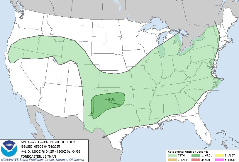
Here is the outlook for tomorrow:

and notice that the majority of Indiana is under this risk. Here are the details for tomorrow:

Right now on radar, as of 8:11, clean sweep. Where are we going, is where the rain is at now, in Iowa. The problem is the front is going to sag in our area and stop, which really, is not. Clouds will follow in today, which means we will go from sunny, to partly cloudy. Temps right now, are in the 70's. Dew points are in the mid 60's, and as you know based on me talking on here, Dew points in the mid 60's, is not comfortable, dew points in the 70's, is not comfortable whatsoever. Now, let's break down the forecast: Pop-up showers across the tri-state starting today, THIS DOES NOT MEAN EVERYONE WILL SEE RAIN. Tomorrow, the cold front will start to make it's way in, and rain and possibly t-storms will be in the area. Now, the storms prediction center has posted us under a SLIGHT risk of severe for tomorrow. I DO NOT agree with the drawing of it. I would draw it from Seymour and Vincennes north to around Ft. Wayne, We will see rain tomorrow, but to really do anything, we have to have winds around at least 30kts for anything to be justified.
More to come later
-E.D.
No comments:
Post a Comment
We encourage you to ask questions and leave comments